

The Lost Treasures of Cornwall: Shipwrecks, Mines, and Legends
Cornwall's lost treasure spans shipwrecks, drowned mines and old legends — and the county's archives make most of it researchable before you set foot outdoors.
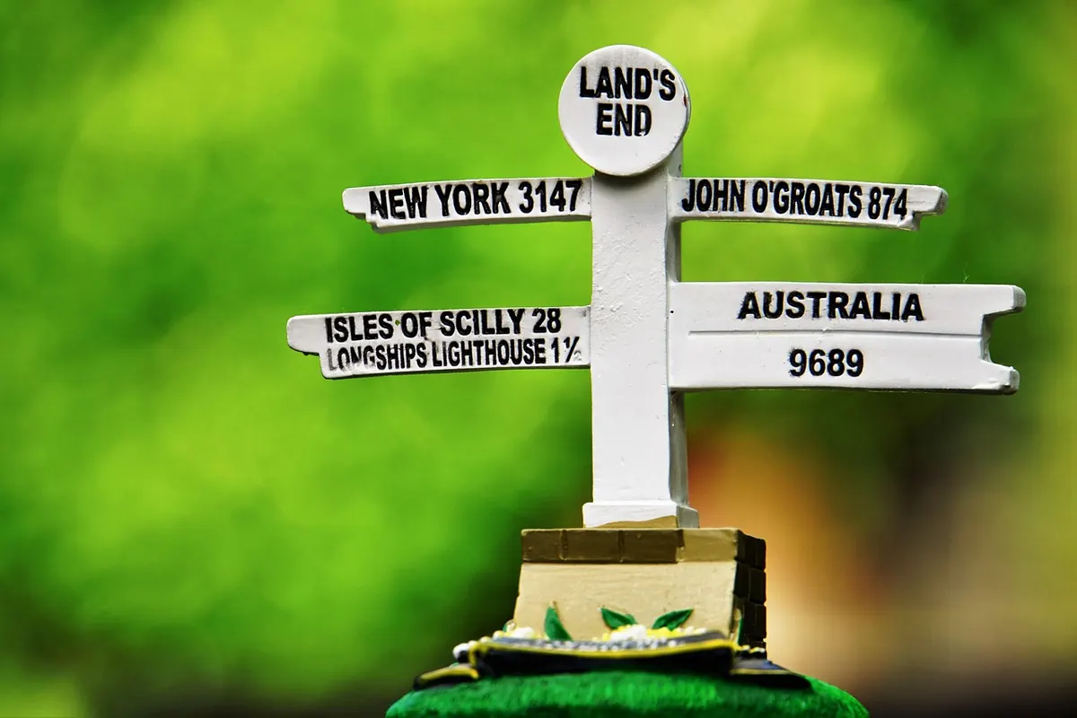
Cornwall loses things well. Cliffs take ships, shafts take tools and machinery, and the moors take the rest — paths, boundaries, whole workings — under gorse and bramble. What remains is a county with an unusually deep supply of lost treasure stories, from cargoes of coin to engine houses standing over flooded ground. The useful part, for anyone curious, is that Cornwall also keeps unusually good records. Most wrecks, mines and legends have left a paper trail somewhere, and following it is usually more productive than digging.
Why Cornwall Keeps Losing Things
Cornwall sits at the wrong end of a busy sea lane. For centuries, ships bound for Bristol, London or Liverpool had to round Land's End, and the options were narrow: deep water with reefs on both sides, weather that turns inside an hour, and charts that were, for much of maritime history, educated guesses. Add the Manacles off the Lizard, the Seven Stones off Land's End, the Wolf Rock, the Isles of Scilly and the crowded Bristol Channel approaches, and you have a coast that has been taking vessels for as long as people have sailed along it.
Inland, the same pattern repeats with tin. Cornwall was one of the world's great producers of tin and copper from the medieval period into the twentieth century. Workings ran out beneath the sea at Botallack and Levant, and deep under Camborne and Redruth at Dolcoath and South Crofty. When metal prices fell through the late nineteenth century, mines closed in waves, and equipment, ore, plans and sometimes whole stretches of tunnel went quiet with them.
The Wreck Coasts
The Manacles
In 1898 the liner Mohegan, on her second voyage from London to New York, struck the Manacle rocks off the Lizard and went down fast, with heavy loss of life. It is one of the best documented wrecks on the Cornish coast, and the site is designated as a protected wreck, which means diving there requires a licence. Even if you never get near the water, the inquiry records, newspaper reports and salvage papers from that single night make a superb introduction to how wreck research works.
The Seven Stones and Scilly
The reef between Land's End and Scilly has a long history of taking ships. In 1707 Sir Cloudesley Shovell's fleet was lost on the Western Rocks in one of the worst naval disasters in British waters, with several ships and their crews gone. More recently, the tanker Torrey Canyon grounded on the Seven Stones in 1967 — a reminder that the hazard did not vanish with sail. Objects from these wrecks turn up in museums, in archive collections and occasionally on the shore.
Wreckers, Salvage and the False-Light Myth
The popular image of Cornish villagers luring ships onto the rocks with lanterns tied to cows is largely a Victorian invention, and local historians have been dismantling it for years. What actually happened was more mundane and more interesting. Coastal communities had a legal and customary interest in salvage: goods that came ashore were claimed, recorded and sold, often through the local Receiver of Wreck's office. Plenty of people made money from the sea without ever wishing a crew harm.
That said, wrecking did occur, and desperation does not improve anyone's morals. If you are chasing a family story about a wrecked cargo, look for the paperwork rather than the folklore: salvage agreements, Admiralty court records and customs ledgers usually tell you what came ashore and who got it.
What the Mines Left Behind
Mine "treasure" is rarely gold. It is ore samples, copper ingots, miners' tools, tally boards, pumps and stamps — and, far more valuably for researchers, plans. Thousands of mine plans survive, showing levels, shafts, lodes and abandoned workings long since vanished from the surface. Some show tunnels driven towards a lode that was never reached, or workings that stopped mid-shift and were never reopened.
Surface clues are still findable on moorland and in spoil heaps: bits of kiln, mundic, dressed granite, fragments of tram rail. What you should not do is follow them underground. Old workings flood, collapse and hold bad air, and no historical curiosity is worth that risk.
Legends with Roots in the Ground
Not every legend is invented. The drowned land of Lyonesse, said to lie between Land's End and Scilly, has a real basis in sea-level change — these islands were once joined by low ground that the sea swallowed over thousands of years. Zennor's mermaid is carved into a church bench end, whatever you make of the story attached. On Bodmin Moor, Dozmary Pool carries the claim that Excalibur was returned to it, and the knockers — the mine spirits said to warn of cracking rock — are a folk memory of a very practical danger.
The lesson for a treasure hunter is simple: legends often mark a real place. A story about buried coins in a field boundary usually points to something worth checking on a map.
Where to Research Cornwall's Lost Treasures
Start with the records. Almost every serious search benefits from an hour in an archive first.
- Kresen Kernow, Redruth — Cornwall's main archive, holding mine plans, tithe maps, estate papers, harbour records and local newspaper runs.
- Cornwall's Historic Environment Record — a mapped record of archaeological sites, mine remains and wreck losses, searchable online.
- National Maritime Museum Cornwall, Falmouth — its research library holds shipping and wreck material for the South West.
- Shipwreck Treasure Museum, Charlestown — collections from local wreck sites, useful for context on what actually survives underwater.
- Historic England's Heritage Gateway — national records for scheduled monuments, listed structures and protected wrecks.
- The Receiver of Wreck at the Maritime and Coastguard Agency — the official route for reporting and tracing wreck material.
- Old maps and charts — Victorian Ordnance Survey sheets and Admiralty charts show shafts, adits and hazards that modern maps omit.
- Local museums and parish records — Penzance, Padstow and Falmouth all hold material that never made it into national collections.
Take notes as you go, and note the reference numbers. An archive visit is far more useful when you can order the same document again six months later.
Before You Go Looking
A few practical points will keep you out of trouble. Get the landowner's permission before detecting or digging on private land, and check whether the foreshore requires a permit — most of it is owned by the Crown Estate, which issues detectorists' permits and asks for finds to be recorded. Never detect on scheduled monuments or protected wreck sites, and stay out of Sites of Special Scientific Interest, which cover a good deal of Cornish coast and moor.
Anything recovered from a wreck within UK waters must be reported to the Receiver of Wreck, who will advise on ownership and any reward. Finds that may qualify as treasure in England and Wales go to the coroner, and your local finds liaison officer can tell you what to do before you lift anything. If you are unsure, ask first and take photographs in place.
Then go and look. Cornwall rewards the patient: a wet afternoon in an archive, a plotted old map, and a walk on the right beach at the right tide will teach you more than any legend ever will.
Photo: Andrew_Poynton / Pixabay